Identify
state-of-the-art, cost-effective drone technologies, sensors, and analytical tools suitable for environmental crime detection in rural areas.
Develop
a comprehensive methodology for drone- based detection of environmental crimes, focusing on illegal logging and waste dumping.
Integrate
selected technologies into a functional prototype and conduct pilot testing to demonstrate effectiveness and usability.
Upgrade
the prototype into a market-ready drone-based monitoring service tailored for rural municipalities, cooperatives, and environmental organizations.
ForestGuard
The main objective ForestGuard was to develop a holistic, drone-based monitoring solution that enables detection of environmental crimes, such as illegal logging and illegal waste dumping, faster, more accurately and more efficiently.


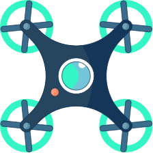
DJI Matrice 350 RTK
DJI Zenmuse L2 LiDAR sensor
DJI Mavic 3 Enterprise Multispectral
LiDAR point clouds, RGB orthophotos, multispectral imagery, NDVI maps and masks.
DJI Terra, R (lidR package, custom scripts), QGIS models.

Outcomes
Working prototype of the solution – drone platform, equipped with sensors, which is able to seamlessly collect all necessary data in operative environment.
Package of open-source analytics software, which includes of-the-shelf open-source software, as well as custom made open-source plug-ins, algorithms and Python scripts.
Drone-based detection of environmental crimes methodology, which is a detailed operational manual for replication of the pilot cases, tailored to Slovenian rural context.
Challenges Faced
Coordination of actions with stakeholders.
Pilot flights were conducted over the summer break period.
Stakeholder expectations.
High false-positive rate.
Impact (Socio-economic & Environmental)
Faster, cheaper detection of dumping and illegal logging hotspots.
Less time and fuel wasted on patrols and manual searches.
Better evidence for follow-up actions and enforcement.
Reduced long-term environmental damage through earlier intervention.
Lower clean-up and remediation costs for municipalities and land managers.
New skills and jobs in UAV operations and geospatial analytics, with privacy safeguards needed.